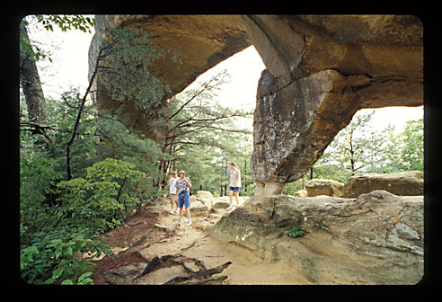
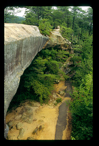
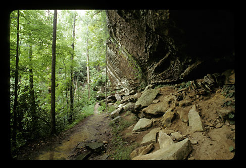
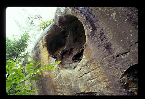
| These pics were taken by John Tichenor August 2001 and February 2002. Additional pictures of the gorge will be added when I find the other roll of film. On my first visit it was very hot and had been raining the night before and hard that day. The redness in the sand matches the Ecktrachome slide using no filters, so the real colors are most likely a little warmer than the cloudy sky shots. I also made adjustments | to the scan to keep the Ektachome look. The streams were out of their banks and had a golden color. On my second visit it had rain right before I got there. However the streams were not up and the Red River had the typical winter type very green pools. The rocks were not as red and had more of a dusty look. Apparently the sandstone rocks need to be saturated with water to look their best. |
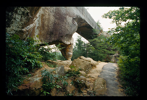
| I have include these on the site as a search of the web did not find any bridge pictures except for one die hard hiker specializing in logging some of the hundreds of bridges. His picture of bridges on the valley floor showed rocks of a dark non-red color. | My pictures are all on or near the top of the ridges of the canyon and close to the road. I think the others are trying too hard to avoid the typical tourist pics like mine. There is also buffalo in a field near by. |
| The Forest Service has a campground (east side) that was open with out the usual water services in February $5. Most campgrounds close everything once freezing weather comes. Call and check on this if interested. There were portajohns and no closed signs although the porta-johns could have been for the maintanence people. The over night user fee for the rest of the area is $2-3 daily or a 3 day fee around $6. Sorry I forget. You are not suppose to camp at any bridge. Other than that the policies of where to camp and on campfires is most liberal. The wilderness area requires a permit and has its own rules. No road side camping in those areas. The problem with the day fee is the visitor center inside the area has limited summer hours. So after you find you like the area it was 25-30 miles to and back from the filling station to get one. $5-7 travel cost. |
|
|
Since I'm not selling anything here is my editorial comment.
Lets hope that Bush will make up for his income tax cuts with some kind of national fee so one can arrive late and legally camp a way from the SMOKY formal campgrounds. I camped in the NW corner of the area next to the gravel road, which was popular both times. The fees boil me as the industry only pays fees for 1/3 of the cost of supplying them with timber, minerals etc. while holding down the sale price of private timber. |
So your income taxes pay for the other 2/3 of the cost, plus the non-commercial cost which if my memory is correct is about 1/3 of the total budget. All though these figures are not up to date you get the jest. I am sure the users % of the income tax $'s going to the Agricultural Dept. is a whole lot more than the total of the industry corporation and individual employee's income taxes. Double boiling is there is a cost to collect too. An advantage is that one of these filling stations had a private map of the area. |
| Red River is located east of Lexington Ky. There is a divided highway from Lexington, which ends just pass Red River. Get off at Slade and take 11 south for Natural Bridge State Park. For the Red River Gorge Loop Road go east or west and take the next road on the north side of the road. Directions for the loop untested. Stop at the biggest filling station in Glade for a map. Except for driving instructions | the Forest Service during non business hours (restrooms open) and the Chamber of Commerice trailer at Slade were of little help. The site Daniel Boone National Forest - Red River Gorge has some good links. My route was driving west through WV I64 tolls and all the way to Winchester (Lexington) and then east on what ever road as it is. It is not identified on their state map. It is an easy one-day drive from Richmond, VA. |
Natural Bridge State Resort Park
has a very impressive natural bridge at the top of the hill. No pics here. There are not any fees to hike. The information trail sign is up the trail so take everything you need when you scout the area and avoid the walk back to the car to get the raincoat. If you can't really walk, there is a lift you can take at a separate location. Plan on at lest an hour.
The Cater State Park north of I64 near WV has some nice tourist cave trips and a natural bridge with a road on top. Very impressive lighting method from a cave photographer stands point. Spot lights for the wet cave and floursants for the dusty cave. The guide said the lighting was depended on the time of installation, but I hope it was for art sake. These are not show stopping beauty or lighting, but a nice walk about and at a reasonable price. Three different caves plus NSS Convention cavers in $600 outfits visiting the "wild caves" explaining that the outfits were required for real cavers. With out the $100 of patches I guess. Their campground is not with in walking distance to the cave park area. You can visit the bridge for free, however while close to I64 it is not much of a rest stop as there is only snack food.